


Parcours 34 Tour du Mont Chéry
Les Portes du Soleil
Parcours Randos, VTT-AE et Trail Running en été


Length
12.5 km

Max alt
1607 m

Uphill gradient
235 m
Km-Effort
16.9 km

Min alt
1164 m

Downhill gradient
601 m
Boucle
No
Creation date :
2023-07-17 13:56:35.849
Updated on :
2023-07-17 13:56:35.849
--
Difficulty : Unknown

FREE GPS app for hiking
 SityTrail
IGN / Geographical institutes
SityTrail Plus
The world is yours!
About
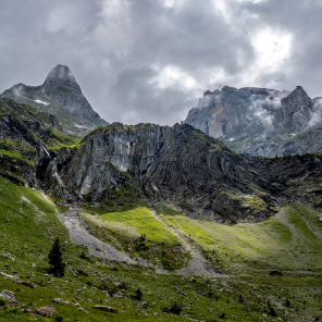
Trail Electric bike of 12.5 km to be discovered at Auvergne-Rhône-Alpes, Upper Savoy, Les Gets. This trail is proposed by Les Portes du Soleil.
Positioning
Country:
France
Region :
Auvergne-Rhône-Alpes
Department/Province :
Upper Savoy
Municipality :
Les Gets
Location:
Unknown
Start:(Dec)
Start:(UTM)
319223 ; 5115104 (32T) N.
Comments